route · Almería
Coastal Drive: Cádiz to Almería
Driving the coastline of southern Spain is an exercise in geological and cultural whiplash, taking you from the wind-whipped Atlantic shores of Cádiz to the scorched volcanic deserts of Almería. This route traces the very edge of the continent, offering a masterclass in coastal navigation along the legendary N-340 and beyond.
route · Almería
Coastal Drive: Cádiz to Almería
14 April 2026 · 10 min read · 2,075 words
Driving the coastline of southern Spain is an exercise in geological and cultural whiplash, taking you from the wind-whipped Atlantic shores of Cádiz to the scorched volcanic deserts of Almería. This route traces the very edge of the continent, offering a masterclass in coastal navigation along the legendary N-340 and beyond.
Tracing the southern hem of the Iberian Peninsula, the drive from Cádiz to Almería is far more than a simple transit between two provincial capitals. It is a 500-kilometre education in how the Mediterranean shapes everything it touches. You begin with the wild, white-capped Atlantic crashing against Roman ruins, and you end amid the dust and agave of Europe’s only true desert.
Many visitors stick to a single stretch of this shore—perhaps a week in a resort on the Costa del Sol or a few days exploring the windsurfing capital of Tarifa. But driving the entire length reveals the raw geographical shift of the region. You will negotiate the twisting, cliff-hugging tarmac of the old N-340, bypass the heavy concrete sprawl of the central coast, and navigate the rutted tracks of the Cabo de Gata natural park.
This itinerary requires a minimum of five days, though stretching it to ten allows for proper detours into the coastal mountains and long lunches in beachfront chiringuitos. It requires a willingness to embrace the changing conditions: the fierce Levante wind in the west, the heavy traffic around Marbella, and the intense, arid heat of the Almerían east. What follows is an unvarnished, stage-by-stage guide to driving the edge of Andalucía, complete with exact road numbers, parking warnings, and the realities of navigating this spectacular shoreline.
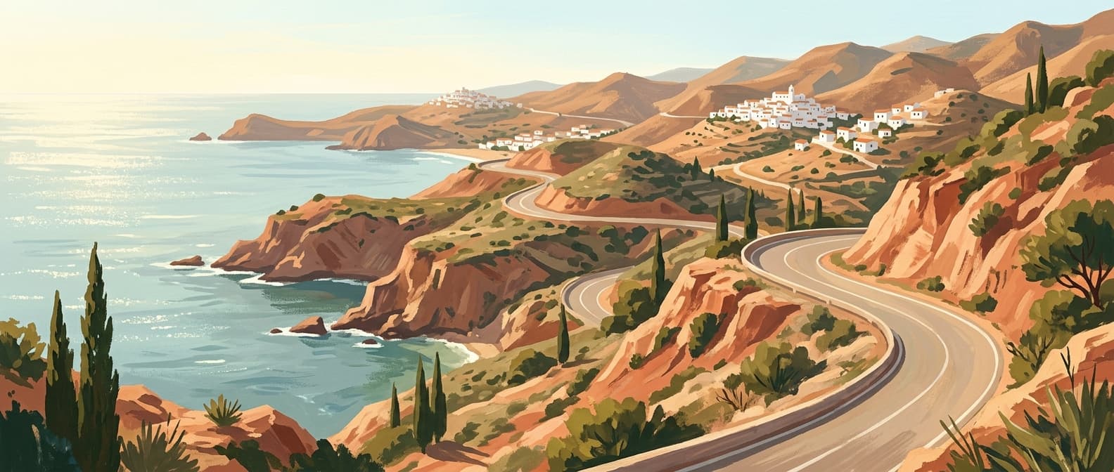
Stage 1: The Windy Coast (Cádiz to Tarifa)
Distance: 105 km | Suggested Time: 1–2 days
Starting from the narrow, sea-lashed streets of Cádiz, head south on the A-48. This dual carriageway offers a smooth, fast exit from the city, slicing past the salt flats of San Fernando. Around the exit for Vejer de la Frontera, the road naturally funnels into the N-340, the legendary national road that will be your primary companion for much of this journey.
Vejer sits high on a hill to your left. If you choose to drive up the twisting CA-5203, be warned: parking in the upper town is notoriously difficult in summer. Leave your car in the lower municipal lot and walk the steep steps to the centre.
Continuing south on the N-340, the landscape opens up. This is the Costa de la Luz, defined by vast, empty beaches and the relentless Levante wind. Turn right onto the CA-8202 towards Bolonia. The ruins of the Roman fish-salting town of Baelo Claudia sit directly on the sand. Park in the designated visitor spaces, walk the boardwalks, and then climb the enormous migrating sand dune that threatens to swallow the pine forest.
Returning to the N-340, you will descend into Tarifa. The crosswinds here can violently shove your car across the lane, so keep both hands firmly on the wheel. Tarifa is the southernmost point of continental Europe. Park outside the medieval walls, as the internal streets are a maze of dead ends. [AFFILIATE: Hotel La Residencia Puerto] offers secure parking and a rooftop pool looking straight across to Morocco.
Stage 2: The Strait to the Rock (Tarifa to Estepona)
Distance: 65 km | Suggested Time: 1 day
Leaving Tarifa, the N-340 climbs steeply into the Parque Natural del Estrecho. At kilometre 91, pull over at the Mirador del Estrecho. On a clear morning, the Rif Mountains of North Africa look terrifyingly close. The road here is single-carriageway, heavily trafficked by transport lorries heading to the port of Algeciras, and passing is rarely safe. Settle into the pace of the traffic and enjoy the severe, rocky drops to the sea.
As you approach Algeciras, the wild Atlantic character fades, replaced by heavy industry and maritime logistics. Follow the signs for the A-7, skirting the vast port and the Bay of Gibraltar. The Rock of Gibraltar dominates the right-hand window. Unless you have planned a specific detour to cross the border—which involves lengthy passport control queues and significant delays—stay on the A-7.
Crossing into Málaga province, you enter the western flank of the Costa del Sol. The coastal road becomes heavily built-up. Your destination for this stage is Estepona. Unlike its heavily concreted neighbours, Estepona has maintained a low-rise, traditional centre with pedestrianised streets heavily decorated with potted geraniums. [AFFILIATE: Estepona historic centre walking tour] is highly recommended for understanding the local architecture. Park in the massive underground car park beneath the seafront promenade (Avenida de España); it is cheap and keeps your car out of the intense afternoon sun.
Stage 3: The Urban Sprawl & Málaga (Estepona to Málaga)
Distance: 90 km | Suggested Time: 1–2 days
This is the most heavily developed section of the Andalusian coast, and honesty is required: the driving here is rarely scenic. You have a choice. You can stick to the toll-free A-7, which threads directly through Marbella, Fuengirola, and Torremolinos. It acts as a local high street as much as a dual carriageway, meaning you will face constant lane-changing, aggressive local driving, and frequent 80 km/h speed cameras. Keep an eye on your mirrors, as motorcycles frequently filter through the heavy traffic around Marbella.
Alternatively, take the AP-7 toll road (peaje). It climbs higher into the foothills, offering sweeping views of the Mediterranean, vastly lighter traffic, and a 120 km/h limit. The tolls are expensive in the summer months, but buying your way out of the coastal traffic jam is usually worth the expense. If you feel the need to break the journey on the toll-free route, pull off at the La Cala de Mijas exit. Unlike the larger resort towns, it retains a walkable, low-rise centre where you can stretch your legs along the wooden coastal boardwalk (Senda Litoral).
Rejoin the coast as you enter Málaga city. The capital of the coast has transformed into a serious cultural heavyweight. Navigate towards the port and park beneath Muelle Uno. From here, the Alcazaba fortress and the Picasso Museum are within a ten-minute walk. Málaga demands an overnight stay. Drive up the steep, winding Camino de Gibralfaro just before dusk. [AFFILIATE: Parador de Málaga Gibralfaro] sits at the summit, offering unparalleled views over the bullring and the harbour. Down at sea level, drive out to the eastern suburb of Pedregalejo to eat espetos—sardines skewered on bamboo and roasted over olive wood fires right on the beach.
Stage 4: Cliffs and Caves (Málaga to Nerja)
Distance: 60 km | Suggested Time: 1 day
East of Málaga, the terrain fractures. The flat beaches end, and the mountains crash directly into the sea. Leave Málaga on the MA-24, which soon filters back onto our old friend, the N-340. The road hugs the shoreline closely, passing through Rincón de la Victoria and Torre del Mar.
The real pleasure of this stage begins as you approach Nerja. The N-340 weaves through agricultural terraces before entering the town. Nerja is extremely popular, and summer crowds are dense. Navigate directly to the underground Carabeo car park. Walk to the Balcón de Europa, a promontory jutting out over the sea, but do not linger long among the mass of tourists.
Instead, drive three kilometres east to the Nerja Caves (Cuevas de Nerja). These massive limestone caverns stretch for almost five kilometres underground, though only a fraction is open to the public. Book your tickets well in advance during July and August. [AFFILIATE: Hotel Balcón de Europa] is an excellent base, constructed directly into the cliff face with private access to a small cove below.
Stage 5: The Tropical Coast (Nerja to Motril)
Distance: 45 km | Suggested Time: 1 day
Crossing from Málaga province into Granada, the N-340 enters the Costa Tropical. This stretch is a masterpiece of road engineering. The highway clings to the sheer cliffs of the Maro-Cerro Gordo natural area. There are frequent lay-bys; use them. The drop to the rocky coves below is staggering, and the water here takes on a deep, unfiltered navy blue.
The microclimate in this valley is unique in Europe. The sheer wall of the Sierra Nevada mountains to the north traps warm air, allowing farmers to cultivate avocados, mangoes, and cherimoyas. The roadside stalls outside Almuñécar sell excellent local produce.
Continuing east, you will spot Salobreña long before you arrive. It is a cluster of white cubic houses stacked aggressively onto a solitary rock rising from the coastal plain, topped by an imposing Moorish castle. Do not attempt to drive up to the castle. The streets narrow to less than the width of a standard rental car, and reversing down a 20-degree incline is an excellent way to ruin a clutch. Park in the lower town and walk. [AFFILIATE: Boutique Hotel Miba] sits on the N-340 just outside town, offering a terrace with dead-centre views of the illuminated castle at night.
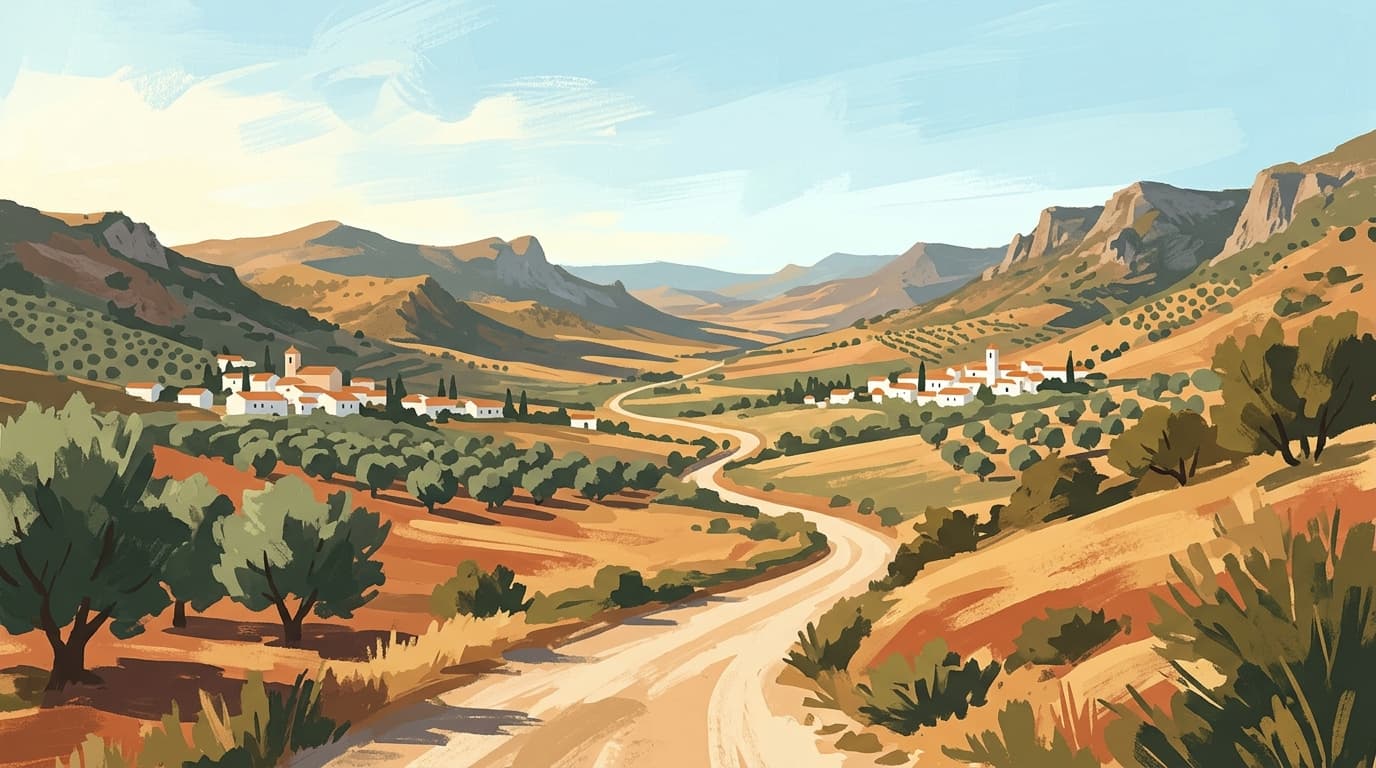
Stage 6: The Plastic Sea to the Wild East (Motril to Cabo de Gata)
Distance: 160 km | Suggested Time: 2–3 days
Leaving Granada province, the N-340 links up with the A-7 autovía for the long haul into Almería. This stretch introduces the harsh economic reality of southern Spain. Around El Ejido, the landscape is entirely smothered by the "Mar de Plástico"—tens of thousands of hectares of white plastic greenhouses. It is visually jarring and brutally hot, but it is the agricultural engine of Europe. Keep the air conditioning high and push through.
Pass Almería city and exit the motorway onto the AL-3115. Instantly, the environment changes. You have entered the Parque Natural del Cabo de Gata-Níjar, an arid, volcanic desert. The road here is arrow-straight, running parallel to the salt flats (Las Salinas). Pull over near the bird hides; you can routinely spot flamingos standing in the pink, hypersaline water.
Follow the road to its absolute end at the Faro de Cabo de Gata (the lighthouse). Parking here is chaotic, often requiring a dusty off-road manoeuvre. Walk past the lighthouse to look down at the Arrecife de las Sirenas, jagged black volcanic chimneys rising from the churning sea.
To reach the isolated coastal villages, you must backtrack slightly and take the AL-3108 into San José. This low-key settlement is the best base for exploring the wild eastern beaches. Access to Playa de los Genoveses and Playa de Monsul is via a heavily rutted dirt track. In peak summer, access for private vehicles is restricted, and you must use the municipal shuttle bus from San José. [AFFILIATE: Hotel Cortijo El Sotillo] in San José provides a brilliant, rustic retreat, complete with horse riding excursions into the desert.
Practical Information
When to Go
Mid-May to late June, or September to October. July and August bring punishing temperatures (frequently exceeding 35°C in Almería) and congested roads. Driving the N-340 in peak summer requires immense patience.
The Vehicle
Rent the smallest car you can comfortably fit your luggage into. The coastal motorways accommodate any vehicle, but the historic centres of Tarifa, Estepona, and Salobreña are terrifying in a large SUV. Ensure your rental agreement covers tyre and undercarriage damage if you plan to drive the dirt tracks in Cabo de Gata.
Costs and Tolls
The AP-7 toll from Estepona to Málaga varies by season, peaking at roughly €10–€13 depending on where you join. It is payable by card at the barriers. Fuel stations are frequent on the A-7, but scarce once you enter the Cabo de Gata natural park; fill the tank in Almería city before heading out to the desert.
What to Pack
The climate varies wildly. Bring a solid windbreaker for the Cádiz coast—the Levante wind is strong enough to scour the paint from cars—and high-factor sunscreen for Almería, where shade is essentially non-existent.
Food and Drink
The culinary shift along this route is as dramatic as the landscape. In Cádiz, focus on bluefin tuna (atún rojo), caught using the traditional almadraba method. Barbate and Tarifa offer exceptional cuts of this fish. As you cross into Málaga, the chiringuitos (beach bars) specialise in pescaito frito (fried fish) and the iconic espetos. Once you reach Almería, the tapas culture shifts. Unlike the western coast, many bars in Almería city and the larger coastal towns still uphold the tradition of serving a substantial, free tapa with every alcoholic drink. Order a cold Alhambra beer and expect anything from stewed pork cheek to fresh grilled octopus to accompany it.
More from Almería
The Ultimate Andalucía Photography Route: Chasing Light Across Southern Spain
Forget the bleached-out midday snaps and crowded tourist viewpoints; photographing southern Spain requires an obsession with timing and terrain. This comprehensive route guides you to the exact coordinates and precise hours needed to capture the region's finest architectural geometry and dramatic geology.
9 min read
Read guide →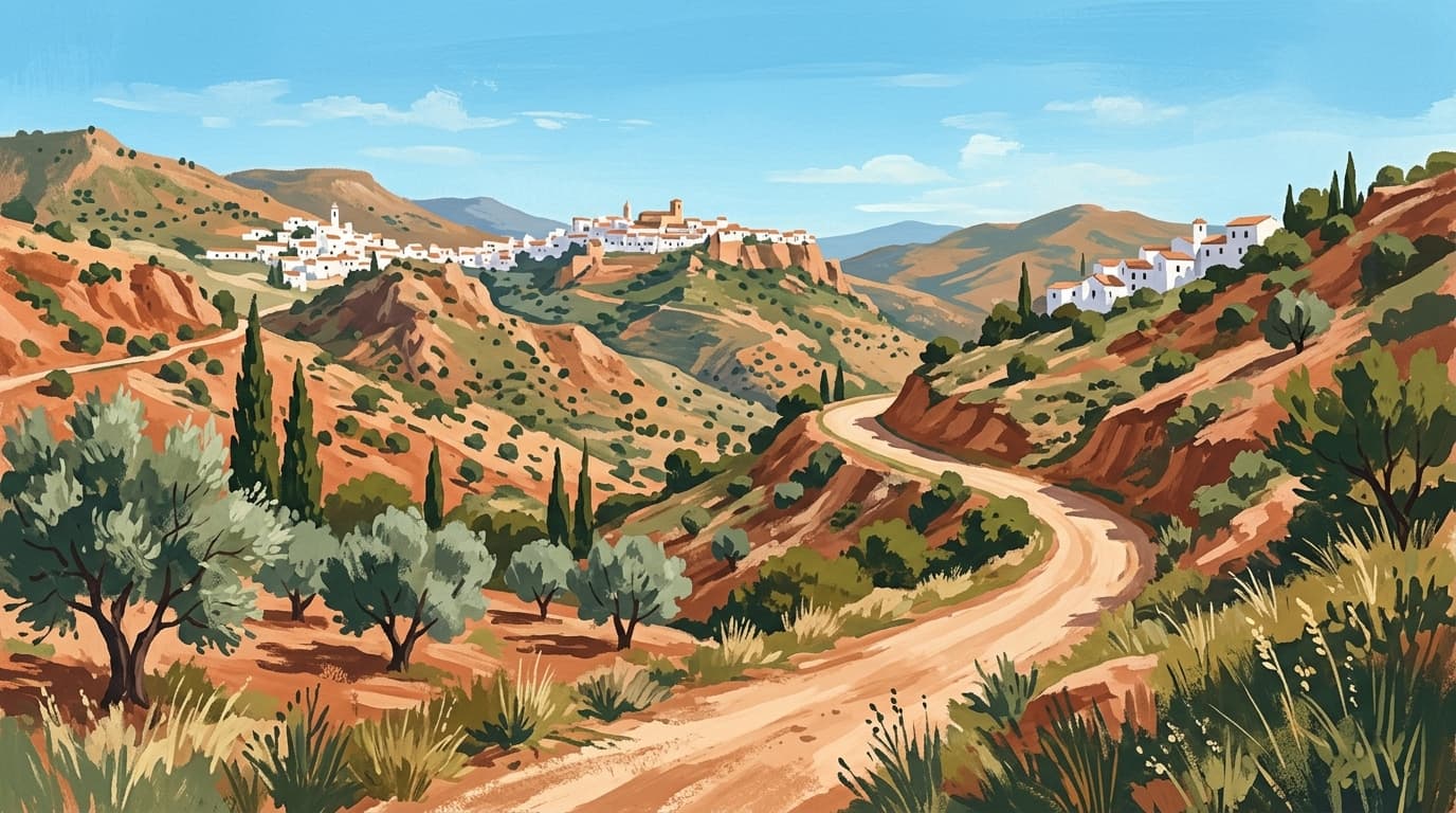
Roman Andalucía Heritage Trail
Before the Moorish emirs reshaped southern Spain, this territory was the fiercely wealthy Roman province of Baetica, a crucial supplier of olive oil and emperors to the empire. This seven-day route traces the classical footprint across Andalucía, leading you from coastal fish-salting ruins and lonely mountain amphitheatres to the architectural remnants that bridged the fall of Rome and the rise of Al-Andalus.
10 min read
Read guide →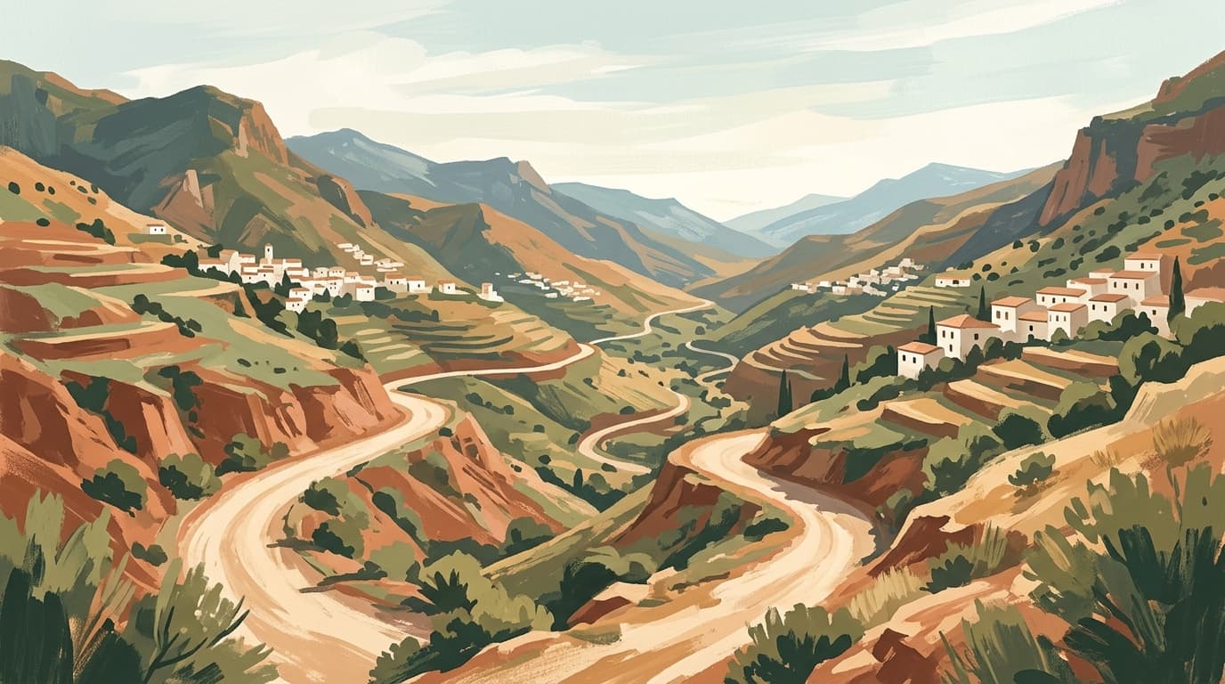
The Alpujarras Complete Guide: High Altitudes and Moorish Footpaths
South of the Sierra Nevada, the Alpujarras is a high-altitude network of steep ravines, ancient irrigation channels, and white villages clinging to the mountainside. This guide covers how to navigate the hairpin bends, where to find the best hiking trails, and which village suits your basecamp needs.
9 min read
Read guide →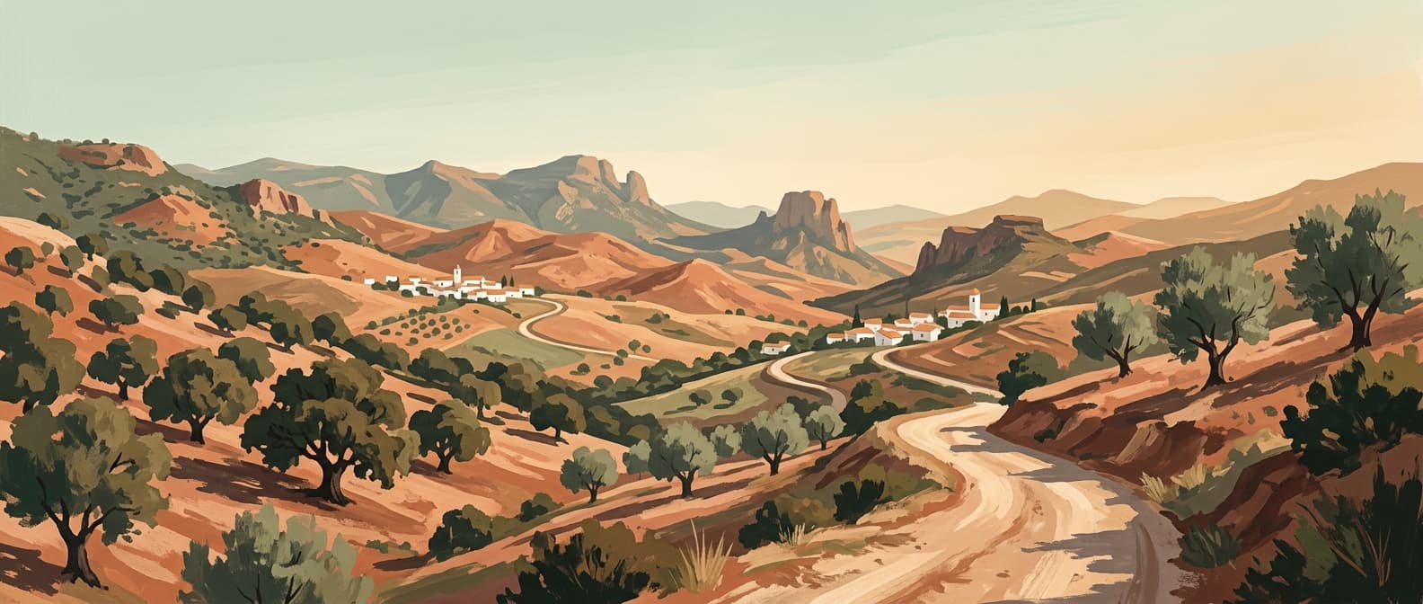
The Ultimate Jamón Ibérico Route: Through Huelva and Córdoba
Tracking down the world's finest ham is an exercise in geography, patience, and appetite. This three-day drive through the ancient oak forests of Huelva and Córdoba takes you straight to the source of authentic Jamón 100% Ibérico de Bellota.
9 min read
Read guide →
Best Weekend Breaks in Andalucía
When you live in southern Spain, the temptation is to spend every weekend repeating the same comfortable Sunday routines. These seven targeted 48-hour itineraries bypass the obvious tourist traps, giving residents and expats a genuine excuse to pack a weekend bag and drive somewhere entirely new.
11 min read
Read guide →
One Week in Andalucía Itinerary: The Classic Triangle & Ronda
Seven days in southern Spain is just enough time to trace the defining Moorish capitals and mountain roads of Andalucía. This itinerary strips away the coastal sprawl to focus entirely on the essential cities of Málaga, Granada, Córdoba, and Seville, returning via the dramatic mountain gorge of Ronda.
9 min read
Read guide →
Budget Backpacker Guide to Andalucía
Andalucía on a shoestring is entirely possible if you know where to eat, how to travel, and which timing tricks unlock the region's monuments for free. This guide strips away the tourist premium to show you exactly how to backpack southern Spain on less than €50 a day.
9 min read
Read guide →
Motorcycle Touring in Andalucía: The Ultimate Rider's Guide
Forget the motorways; Andalucía’s true character is carved into its mountain passes, where immaculate asphalt drapes across deep ravines and high-altitude plateaus. This is a landscape built for motorcycles, offering thousands of kilometres of technical riding without a straight line in sight.
9 min read
Read guide →
Feria de Abril Complete Guide: Surviving and Thriving in Seville's Greatest Week
Seville’s Feria de Abril is notoriously impenetrable for outsiders, a closed-doors celebration of Andalusian high society and endless rebujito. This guide strips away the confusion, detailing exactly how to navigate the public casetas, master the unforgiving dress code, and survive a week on the sand of Los Remedios.
10 min read
Read guide →Newsletter
More stories from Andalucía
Weekly notes, seasonal picks, and the next guides worth bookmarking.